
On the rivers, reforested hills, mangroves, caves, weaving communities and working towns of Caticlan, Malay and wider Aklan, and why the landscape that makes a famous island intelligible is the one most journeys cross in minutes: a destination-intelligence guide for the new citizen of the world
Most journeys to Boracay begin with an act of looking past something.
Passengers land at Caticlan, collect their bags, board a van, cross the mainland and move toward the jetty. The goal is the island, and everything before the boat feels provisional. But beyond the transfer route are rivers, reforested hills, mangroves, caves, farming traditions and quiet coastlines that reveal a different Aklan, and a different way of understanding the island itself.
Boracay may be the destination people fly for, but mainland Aklan is the landscape that makes the journey intelligible. It is a small island, roughly ten square kilometres off the northern tip of Panay, and it draws far more attention than the province that surrounds and supplies it. This essay does not offer a list of things to do before or after the beach. It asks what happens when one world-famous destination becomes so powerful that the landscape around it disappears from the traveller’s imagination, and what a traveller might notice by moving more slowly through it.
The approach here is destination intelligence: reading a place the way an analyst reads a market. Who passes through it, and who stays? Which parts are named on maps and which parts are only crossed? What does fame simplify, and what does it cost the places beside it? A traveller who asks those questions before arriving tends to see more on arrival, and to leave more lightly. That is the practical case for the mainland: it is the part of the journey where the context lives.
Caticlan: The Gateway Everyone Uses and Few People See
A gateway is still a place.
Be precise about the place. Caticlan is a barangay within the municipality of Malay, Aklan, not a city, and its importance is strategic. Godofredo P. Ramos Airport and the Caticlan jetty port concentrate movement here, as the principal gateways to Boracay and an entry point to the wider island of Panay, with Kalibo’s airport serving as the other major air gateway. That concentration is exactly why many travellers experience the mainland only in fragments: an airport road, a transfer, a queue at the port.
Is there anything to do in Caticlan besides going to Boracay? Caticlan is mainly a transport gateway, with the airport and jetty port for Boracay, but it sits within the municipality of Malay, whose mainland includes forest, river and cave sites, a living-museum community, and an ecological park with views toward the island. The most rewarding approach is to treat Caticlan as the start of a mainland itinerary, not only a transfer point.
Is Caticlan worth exploring? Caticlan itself is a working gateway, and its value is as a threshold: it is the quickest way into mainland Malay’s inland and coastal sites. Travellers who add an extra morning before or after the crossing tend to see far more of the municipality than the transfer route suggests.
It is worth asking what a gateway is. The traveller’s relationship with Caticlan is usually functional, which makes it an interesting place to consider how tourism can make entire communities visually disappear when they sit beside a more famous destination. People live and work around the jetty, the road and the market, and the logistics that look like background are the daily life of a municipality. The practical advice that follows from this is modest and valuable: an extra morning before the boat, or a slower transfer, changes what a trip can contain, and the sort of travel essentials that keep a transfer day light and unhurried make that easier.
Reading the Geography: Panay, Aklan and a Small Island
An icon is easiest to understand from its surroundings.
Boracay sits just off the northern tip of Panay, close enough to the mainland that the two form a single system: the island depends on the mainland for air and sea access, labour, food and, in many practical ways, the water and the coastline that connects them. Seen on a map, the famous island is a small shape beside a large one, and the distance between the two is the width of a short boat crossing. Seen from the ground, the pattern is the same. Everything that makes the island function arrives through the places the traveller passes on the way.
This is the first lesson of destination intelligence: the icon is rarely the whole system. A resort island is a concentrated output of a larger landscape, and a traveller who understands the larger landscape reads the island better. The rivers that begin in reforested hills, the mangroves that hold the shoreline and the working towns that supply the visitor economy are not extras. They are the structure the island rests on.
Malay Beyond Boracay
The municipality known globally for one island also has a mainland story.
Official and government tourism material identifies a mainland Malay with its own attractions: the Malay Ecological Park, the Nabaoy reforestation and river, caves, springs and waterfalls, and the Motag Living Museum. The Philippine Information Agency’s feature on mainland Malay makes the case plainly: there is more to Malay than Boracay Island, and its inland places are waiting for visitors who look past the beach.
The Malay Ecological Park, in Barangay Argao, offers a useful reversal of perspective. It is described as a rural eco-tourism attraction, and its fruit-tree setting introduces the inland ecology that contrasts with the island’s polished resort image. Its viewpoint is described as showing Boracay from the mainland. Most visitors look outward from the island. This is the view from the land that receives, supplies and connects it.
What can you do in Malay, Aklan outside Boracay? Outside Boracay, Malay offers the Malay Ecological Park in Barangay Argao, the Nabaoy river and reforestation area, the Motag Living Museum, caves such as Pangihan, and waterfalls and springs such as Agnaga Mini Falls and Cold Spring and Nagata Falls. Access, guide requirements and conditions change, so check with local tourism offices before visiting.
Nabaoy: Forest and River Behind the Island
The landscape tells a story about water.
Nabaoy is the section of the mainland that most changes expectations. The Boracay imagination is dominated by beach, but the nearby mainland contains forested terrain and a river that official material describes as clean, winding through green cover; the Philippine Information Agency’s feature calls the Nabaoy River the cleanest river in Malay. Officials in Malay have also pointed to what the river holds: marine and freshwater resources, among them a traditional shrimp known as patuyaw that a local tourism official described as found only in the Nabaoy River, and forest and cave habitat that the same feature calls a wildlife sanctuary.
Treat the river and the reforestation as ecology, not only recreation. A reforested slope and a clean river are the work of years, and they are part of what keeps a coast stable. The landscape here tells a story about water that begins inland and ends at the beaches the island’s visitors came to see, which is the single clearest reason for the mainland to be understood as part of the destination.
Buruanga: A Different Coastline
The coast has more than one identity.
To the west, Buruanga widens the story beyond Malay. It spreads along the northwest coast of Panay, within reach of the Northwest Panay Peninsula Natural Park, and its tourism portfolio includes caves, waterfalls, white-sand beaches, mangroves and quieter coastal terrain. Hinugtan White Beach, reached by boat and backed by hills, Pagatpat Mangrove, with a bamboo trail through the forest, and caves such as Sabang and Ignito sit alongside the walking trails of Hacienda Maria.
The point is not to offer secret alternatives or substitutes for Boracay. It is to show that Aklan’s coastline has multiple identities, and that the white sand the island is famous for is one expression of a coast that also includes mangrove, cliff, cave and fishing community. A traveller who understands that variety is less likely to ask the mainland to be a cheaper Boracay, and more likely to meet it on its own terms.



The Crossing, the Town and the Mangrove Marker
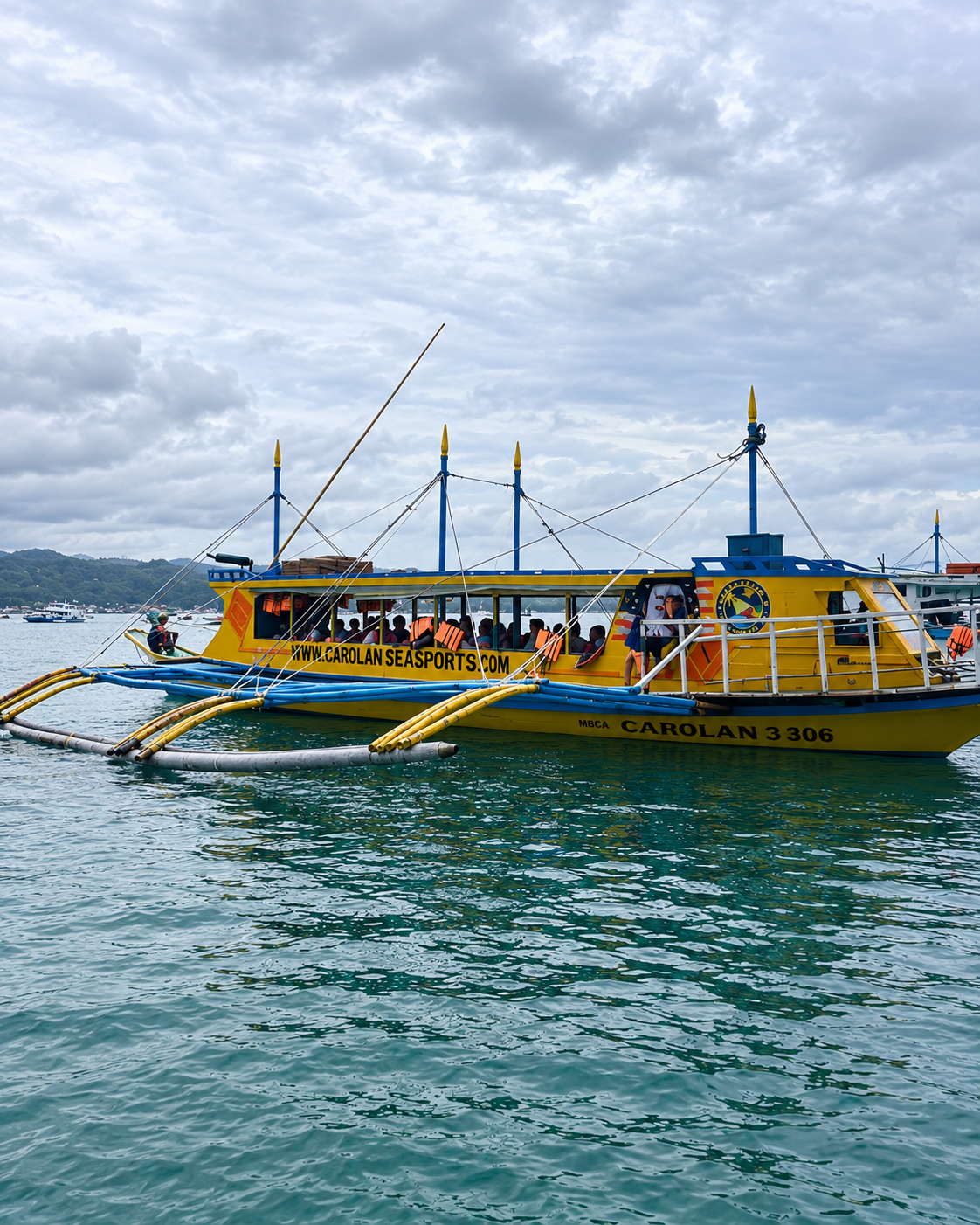
The second gallery moves from water to town to forest. A double-outrigger passenger boat sits on green water, the vessel type that makes the short crossing possible and reminds the reader that the sea is a working road here before it is a view. A timber gateway in a Southeast Asian temple idiom, with seated guardian figures flanking a paved path, shows how resort and wellness design on this coast often borrows its vocabulary from elsewhere in the region, which is worth noticing precisely because the next frames are so specifically local.
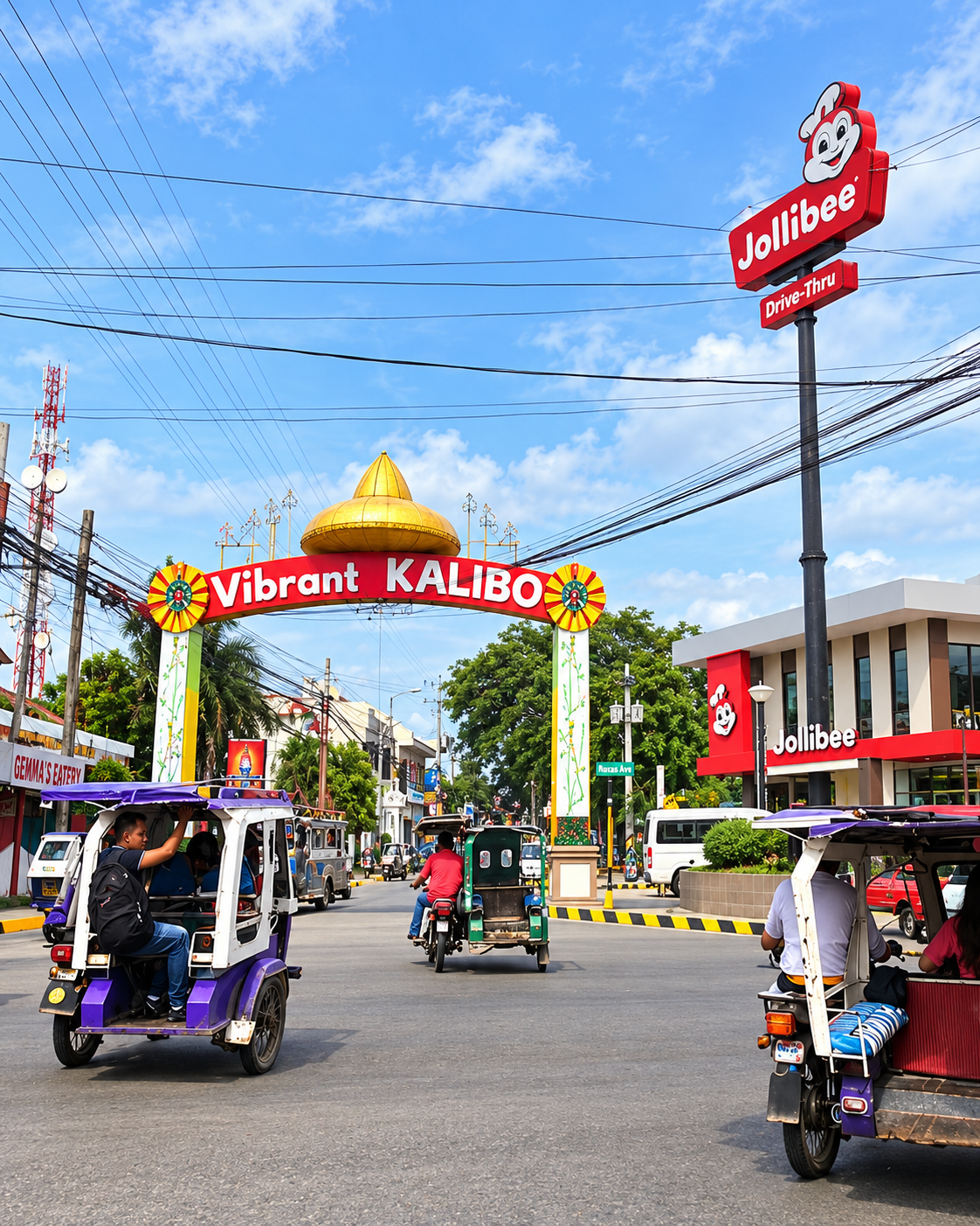
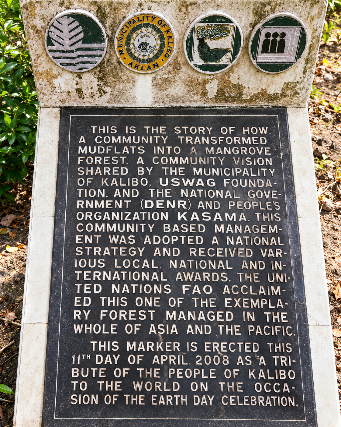
That specificity begins with the “Vibrant Kalibo” arch, a town gateway over a busy junction where motorised tricycles, overhead cables and a fast-food sign share the frame. It is an honest picture of a Philippine provincial capital as it actually works, and it is the corrective to any idea that the mainland is scenery waiting to be visited. The fourth frame is the most informative document in the set: a commemorative marker at the mangrove park, with text that tells the story of how a community transformed mudflats into a mangrove forest. It credits the Municipality of Kalibo, the USWAG Foundation, the national environment department and the people’s organisation KASAMA, states that the community-based management approach was adopted as a national strategy, and records that the United Nations Food and Agriculture Organization acclaimed the site as one of the exemplary forests managed in Asia and the Pacific. The marker is dated 11 April 2008 and was erected as a tribute to the world on Earth Day, so the claim is the community’s own, recorded in stone, and should be attributed that way.
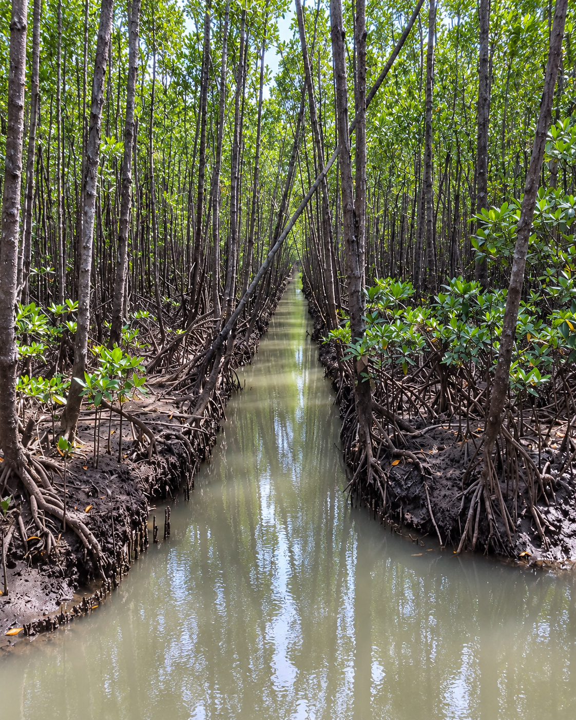
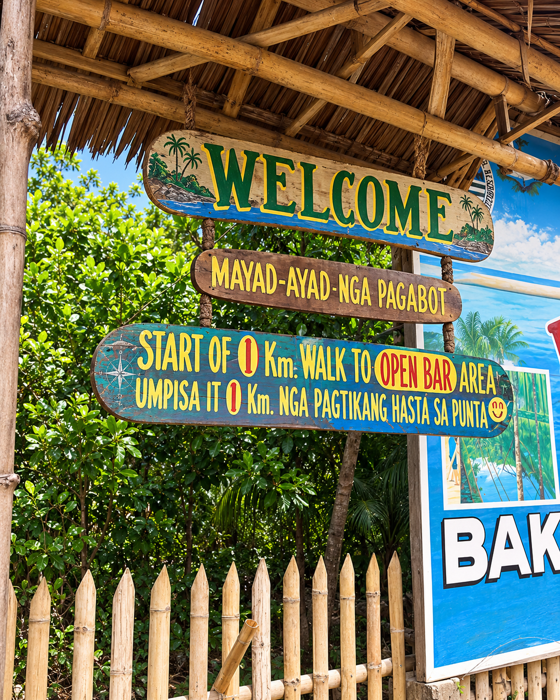
The last two frames show what that history looks like on the ground: a straight, narrow waterway between ranks of tall planted trunks, and a thatched signpost welcoming visitors in the local language and marking the start of a walk. Between them they make the case for the next section. A mangrove park is a designed landscape with a founding story, a boundary, a path and a welcome, and understanding that story is what separates a visitor from a spectator.
Why Aklan’s Mangroves Matter More Than Their Photogenic Appeal
The landscapes that protect a coast rarely look like the landscapes tourism puts on postcards.
Mangroves are less glamorous than white sand, and more important. They are habitat, nursery ground, shoreline protection and a living ecological system, and Aklan offers several of the most instructive mangrove stories in the country.
Where can you see mangroves in Aklan? Aklan offers several mangrove sites: Bakhawan Eco-Park in New Buswang, Kalibo, a community-led mangrove rehabilitation of about 220 hectares; Katunggan it Ibajay in Ibajay, noted for its diversity of mangrove species and century-old trees; and Pagatpat Mangrove in Buruanga, with a bamboo trail. Each is a protected or managed ecosystem, best visited with local guidance.
Bakhawan Eco-Park is a case study in community stewardship. It began in 1990, when the Kalibo Save the Mangroves Association, a local community organisation, set about turning degraded mudflats into a mangrove plantation, initially on about 50 hectares, working with the municipality and the environment department. Press and research coverage, including Mongabay’s reporting, describes how the restored forest became both a protective buffer for the community and a major attraction, and the park has since grown to roughly 220 hectares. It offers storm-surge protection and livelihoods as well as a boardwalk. The park’s own commemorative marker, photographed above, names the Municipality of Kalibo, the USWAG Foundation, the environment department and the people’s organisation KASAMA as the partners behind the story and records the FAO’s acclaim, so the credit to community groups is best given as the marker gives it, since press accounts name the original local organisation differently. Another site, Katunggan it Ibajay, a mangrove eco-tourism park of about 44 hectares, was described by local officials and a regional newspaper in 2010, citing the Southeast Asian Fisheries Development Center, as holding 28 mangrove species, about 80 percent of the country’s total, including century-old piapi trees. A Daily Guardian report describes the park as established under a 2009 municipal ordinance and jointly managed by the local government, the environment department and the Zoological Society of London, with a boardwalk and viewing deck. Both are best understood as infrastructure that happens to be beautiful, not scenery that happens to be useful.
The traveller’s role is small and clear: stay on the boardwalk, take nothing from the forest, listen to the guides and treat the roots as a working part of the coast and not a photo backdrop.
Shoreline, Wrack Line and the Evening Reset
The third gallery is a study in coastlines and the small logistics of a coastal day. The first frame is a dusk shore under a pink and lilac sky, with surf running onto wet sand and a dark band of seaweed along the tide line. Tides and seasons leave that kind of wrack on many tropical beaches, and it is better read as a natural line on the shore than as a verdict on it; the useful habit is to ask locally what a beach is doing before deciding what it means.
The second frame is quieter and more instructive: two rounded stumps of palm, still wrapped in their own fibre, standing on pale sand beneath a heavy sky, with boats anchored far out. A shoreline is a moving boundary, and it was the placement of buildings too close to that boundary that the government cited when it closed Boracay in 2018. A coconut palm that has outlived its place on the beach is a small, honest marker of how much a coast changes. The third frame turns indoors, to a bright room with a tropical print on the wall, which is the other half of a coastal day: the place where salt, sun and sand are rinsed away and a face and a scent are chosen for the evening. The ritual is ordinary, and it is the reason the later sections of this guide pay attention to skin and fragrance in heat.
Kalibo: The Provincial Capital Boracay Travellers Often Skip
Why do visitors sometimes know a province’s resort better than its capital?
Kalibo is the provincial capital and a useful counterweight to resort tourism. It is also an air gateway to Boracay, which is exactly why its identity as a town in its own right is so often skipped. Bakhawan lies a short distance from the centre, and the capital holds the cathedral, markets, a deep food culture and the Ati-Atihan Festival that defines its January calendar. It invites a larger travel question: why do visitors sometimes know a province’s resort better than its capital?
Is Kalibo worth visiting if you are going to Boracay? Yes, for travellers who want to understand Aklan beyond its resort. Kalibo is the provincial capital and an air gateway to Boracay, with the Bakhawan Eco-Park mangrove forest, the piña weaving tradition recognised by UNESCO, local food and market life, and the cultural identity of the Ati-Atihan Festival. A day or an overnight stop adds context that the island alone cannot provide.
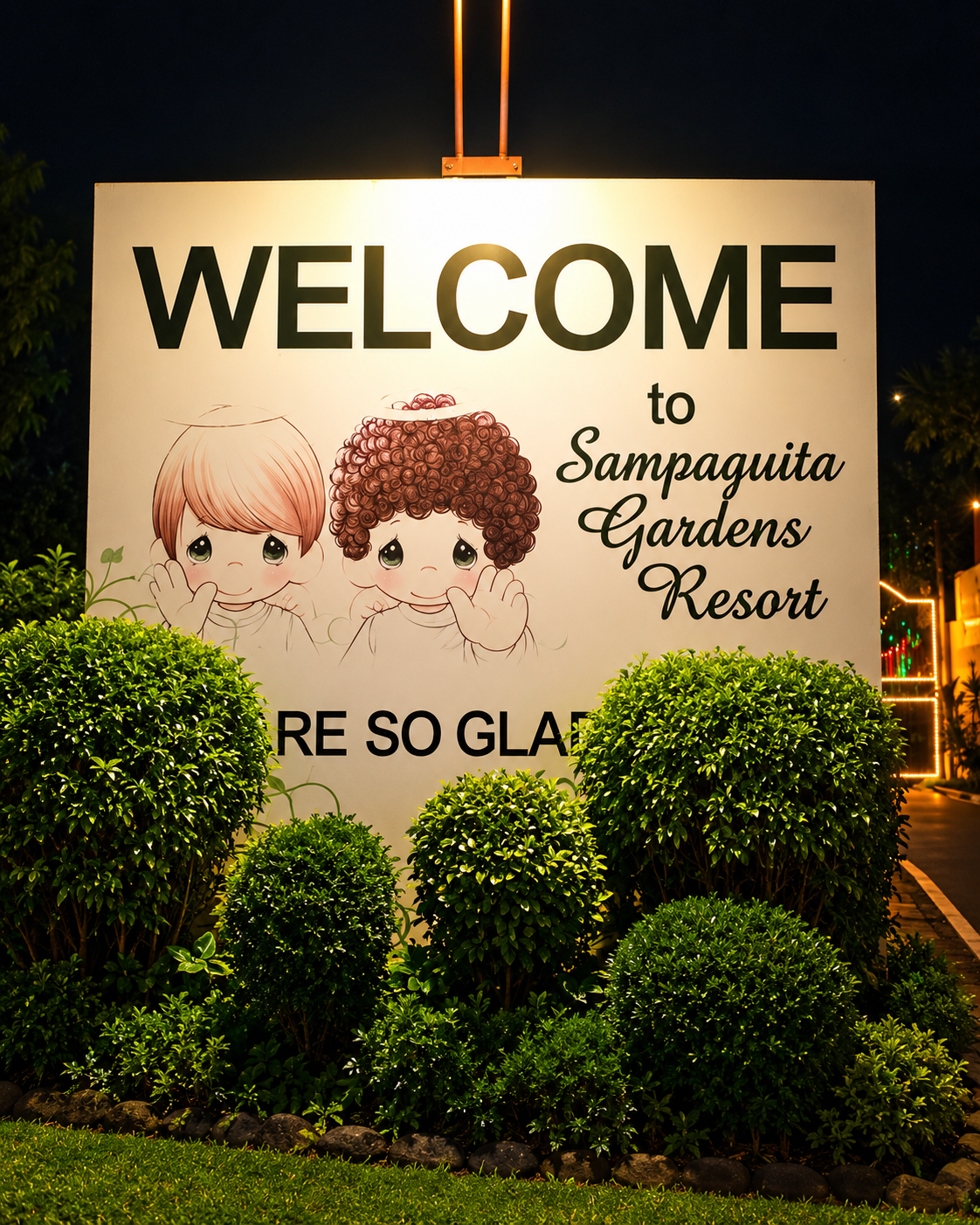
Nearby, in New Washington, a very different kind of place illustrates the province’s unexpected corners: Sampaguita Gardens, a Christmas-themed garden and resort created by the American artist Sam Butcher, known for the Precious Moments figurines, offers a Victorian-style cottage devoted to Christmas all year. It is a private property, and its facilities have aged, according to some visitors’ accounts, so it is best read as a curiosity of the mainland, not a pillar of it.



Sampaguita Gardens, Frame by Frame
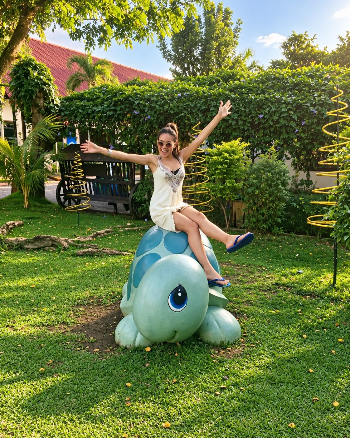
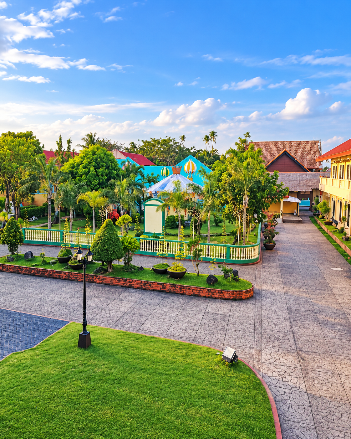
The galleries that follow show a place built entirely from imagination, and the sequence reads as a procession. An illuminated welcome sign, decorated with illustrated children in the style of the collectible figurines the resort’s founder is known for, greets arrivals at night. By day a smooth green turtle sculpture sits on a lawn, a paved lane runs between rows of angel figures under star-shaped ornaments, and an elevated view shows pastel buildings, clipped lawns and a pale paved court. Indoors, a room of costumed collectible dolls sits before a painted castle backdrop between two Christmas trees, and the last frame shows a dining table laid with a plaid cloth beneath a nativity scene.
For a reader interested in destination intelligence, this is the most useful kind of oddity. Themed tourism is a deliberate strategy: a single idea, repeated at every scale from the signboard to the dinner table, produces a destination that needs no context. Here the idea is year-round Christmas on a tropical coast, which is precisely why it sits so comfortably beside the province’s far older traditions of weaving and festival. It is a private property, it is best approached as a curiosity and not as a pillar of the mainland, and visitors should check its current status before making a detour.





Piña, Food and the Material Culture of Aklan
A place can be understood through what it knows how to make.
Piña is a textile woven from pineapple-leaf fibre, and in December 2023 UNESCO inscribed Aklan piña handloom weaving on its Representative List of the Intangible Cultural Heritage of Humanity. UNESCO’s description records the detail that matters: piña is made from pineapple leaf fibres and woven on a handloom, and the knowledge and skills are primarily passed on within families, with children learning by watching older relatives, as well as through Schools of Living Traditions set up by local communities in partnership with the government. Accounts of the inscription note that it was the first intangible heritage element from the Visayas to be listed. In the draft this essay grew from, farmers harvest the leaves of a specific pineapple variety, the fibres are extracted by hand and weighed by a local method involving old coins. It is the most highly regarded of the Philippines’ traditional textiles, and a preferred fabric for formal attire.
The story is about labour, knowledge, material and continuity, not shopping. A census of piña workers in Kalibo carried out in 2018 and 2019 raised concern about the shortage of younger weavers, a reminder that a craft’s survival is not guaranteed by its recognition. A craft that makes its patience visible is a principle Japanese beauty philosophy describes in another field: the process is not a preliminary to the object. It is the object.
Food offers a similar register of everyday knowledge. Local tourism materials point to the province’s specialities and daily dishes, including sausages, barbecue traditions and preparations associated with the mangrove environment. The stronger angle is that mainland food reflects agriculture, fishing, market life and local routine, and tastes of place differently from resort dining: an Aklan that cooks for itself. A market breakfast in a mainland town is, in this sense, a piece of fieldwork.




What Boracay’s Fame Hides
Destination fame simplifies geography.
One image becomes dominant, white sand, sunset, resort, nightlife, and the landscape that produced it recedes. The island’s own recent history shows why that matters. In April 2018 the Philippine government closed Boracay for six months after its president called it a cesspool, citing sewage discharged into the sea and buildings constructed too close to the shore. When it reopened in late October 2018, Reuters reported that officials would allow 19,000 tourists on the island on any given day, and cap workers at 15,000, to keep the island below a carrying capacity of 55,000, on a tiny island of about 10 square kilometres. Figures for the cap were reported differently by different outlets, a reminder that numbers in a fast-moving policy story are best attributed.
Read as intelligence, the episode is a lesson in how a small place absorbs the attention of a large one. A carrying capacity is a statement about shoreline, waste and water, not marketing, and it explains why an island’s managers speak in numbers that visitors never see. It also explains why the mainland matters to the island’s balance: labour, food and supplies all arrive across a short strait, so a traveller who understands Aklan reads Boracay’s rules as sensible limits and not as arbitrary inconvenience.
The same simplification shapes how the island is pictured. One beach, one sunset and one stretch of sand stand in for a place that has two coasts. White Beach faces west, and its sunsets are the island’s postcard. On the opposite side, the east coast faces the wind, and it has a different character altogether: kites instead of crowds, working boats instead of cocktail hour, a horizon that moves. The traveller who sleeps on that quieter side sees the island’s second identity, and that is the case for treating a stay as part of the research.
What does Boracay’s fame hide? Boracay’s fame hides the mainland landscape that surrounds and supports it: the forests, rivers, mangroves, craft traditions, food culture and working towns of Caticlan, Malay and wider Aklan. The island is a small, intensively managed destination, and the larger geography around it is where much of the region’s ecology and cultural memory sits.
What nature attractions are near Boracay? On the mainland, within reach of Caticlan, are the Nabaoy river and reforestation area, caves, springs and waterfalls in Malay, the Malay Ecological Park, and further afield the mangroves of Buruanga, Ibajay and Kalibo. Access varies and some sites require local guides, so check with tourism offices first.
A Stay on the Windward Side: Palassa Private Residences
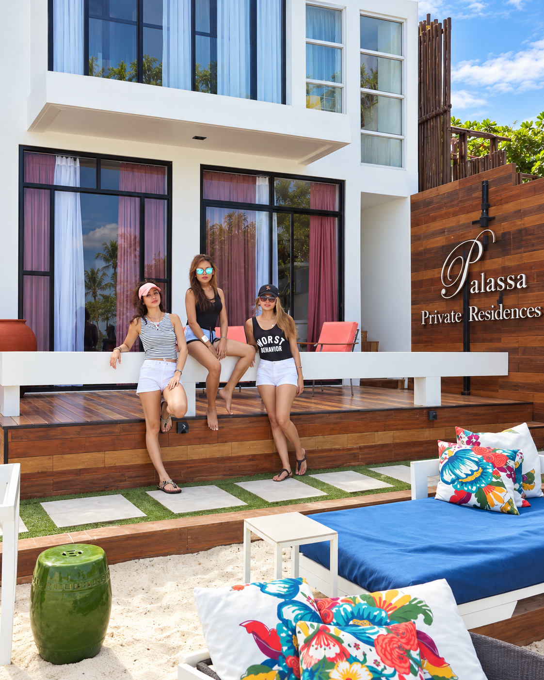
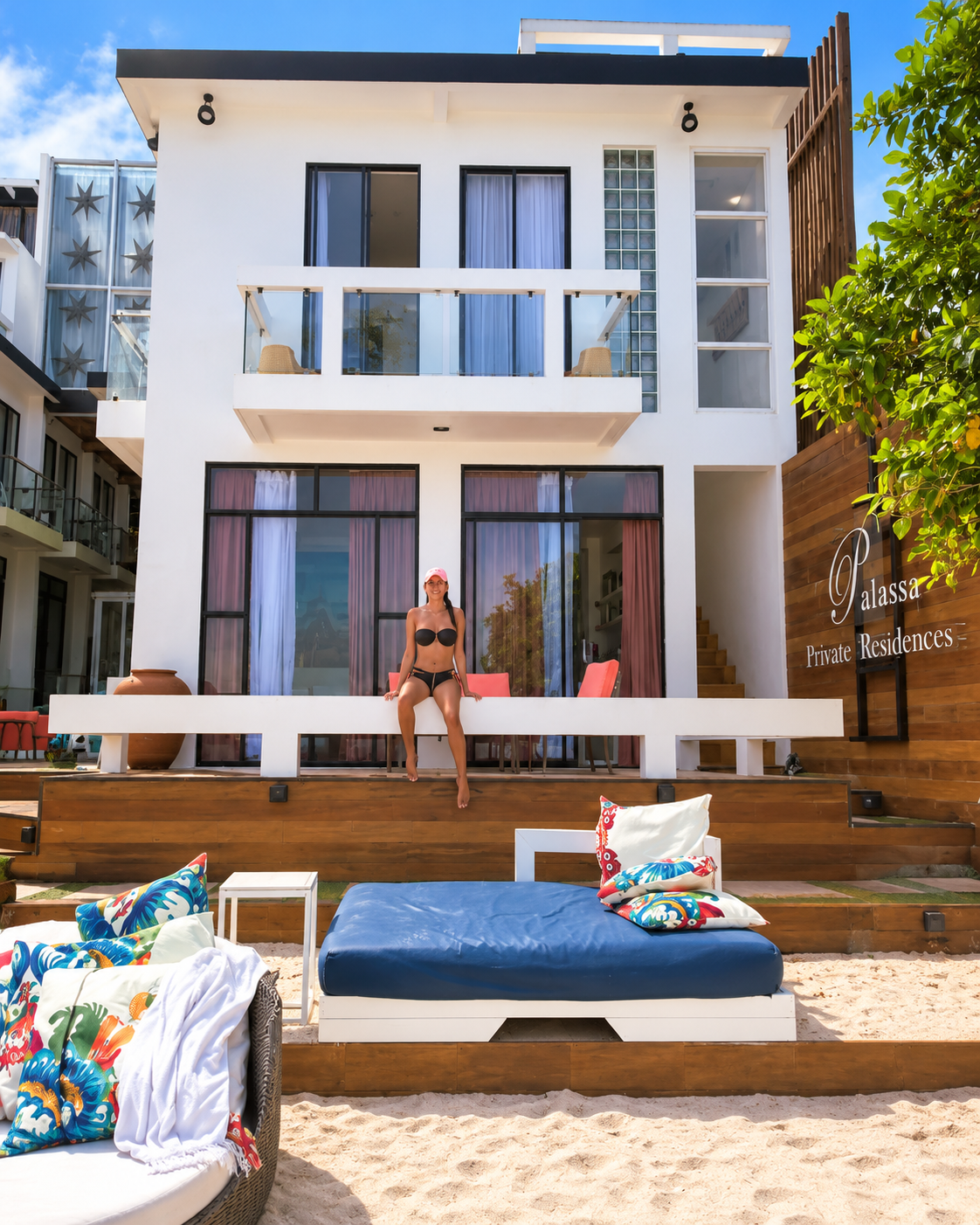
Palassa Private Residences on Bulabog Beach, in Barangay Balabag, is a small property built in 2013, with ten rooms across three levels, an art gallery on site and loungers set out on the sand. Bulabog is on the eastern, windward side of Boracay, where the amihan wind between October and April makes it one of the region’s kiteboarding and windsurfing coasts. The property’s name is a useful correction in itself: it is a set of residences, an aparthotel, and not a resort, and the difference in scale shapes everything about the stay.
The experience is easiest to describe through three observations. The first is orientation. Rooms with tall glass and balconies face a sea animated by kites and boat traffic instead of sunset crowds, so the day begins with a horizon in motion. The second is scale. With only ten rooms, the beach in front of the building is shared among few people, and the daybeds on the sand, dressed in garden-print cushions, feel closer to the terrace of a private house than to a hotel pool deck. The third is material. White render, warm timber, tropical prints and the green glaze of a ceramic stool make a vocabulary of a house by the water, and the design makes the argument of this essay at the scale of a room: comfort that comes from attention, not volume.
Location completes the picture. By the distances that listings give, White Beach, D’Mall and the island’s evening life are about a ten-minute walk away, which turns the stay into a choice of two Boracays. The traveller can spend morning on the quiet east side, join the west for sunset and return to quiet afterwards. That ability to enter the crowd and leave it is a spatial form of luxury, and it is available only on an island small enough to cross on foot. Listings also describe the on-site gallery as a showcase for local artists, a small cultural anchor that gives a ten-room property a point of view about where it is.
The stay also connects to the mainland story. A traveller sleeping beside the wind and the working boats is already thinking about how the island functions, and is better prepared to look across the strait toward the forest, river and mangrove that support it. Services, room types, transfers and rates at any property change, so confirm details directly before booking.
None of this argues that travellers are wrong to go. It argues that a destination becomes richer when the traveller understands the landscape around the icon. Resort islands can be assembled for the camera, and the mainland is a reminder of what a place is made of before it is staged. Attention concentrates easily on the famous, and credibility and depth are built elsewhere. The mainland complicates the dominant image, and the complication is the point.





Cebu and the Island, in Twelve Frames
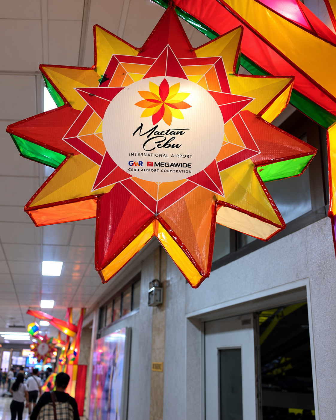
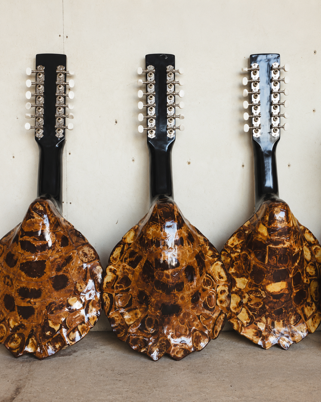
The last two galleries widen the lens, and the first of them leaves Aklan altogether. An aerial view on approach to Cebu shows tidal ponds and a ragged mangrove edge between the sea and a city skyline, the kind of working wetland that sits beside most Philippine cities and is rarely noticed from the ground. A hilltop monument shows a bronze figure with a sword and shield, which reads as the Lapu-Lapu monument on Mactan; a second aerial follows a long coastal road beside a reef-fringed sea. At street level, a market stall hangs dried goods beside woven bags and souvenirs, an airport corridor is lit by a star-shaped Christmas lantern bearing the airport’s name, and a row of instruments with shell-patterned bodies leans against a wall. Cebu is one of the hubs through which journeys to the Visayas are routed, and the gallery shows what a hub looks like when the traveller slows down: a wetland, a monument, a market and an airport that decorates itself for a festival.
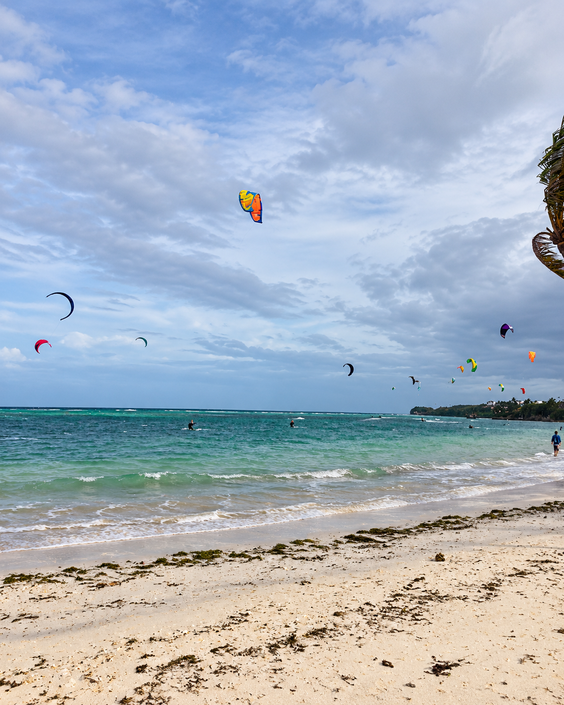
The final gallery returns to Boracay, and to the contrast between its two coasts. Kites fill the sky above a bright sea on the windward side, which is the Bulabog side of the island, where the wind is the attraction. Three frames show Palassa Private Residences, white, modern and lined with timber, with daybeds on the sand: the quiet end of the island’s accommodation, and an example of the design-led comfort described in section 13. Between them sits a wall of glass jars in a Kalibo coffee-and-tea counter, labelled with Philippine regional names such as Barako, Sagada, Kalinga and Mt. Apo, a shelf that works as a map of the archipelago’s growing regions. A small passenger boat at a jetty, with the green hills of the mainland behind it, closes the sequence where the journey began: at the crossing.
The Cebu stall is also a reminder that souvenirs carry provenance. Where an object’s body looks like natural shell, or where an item is sold dried, the respectful question is what it is made of and where it came from, and travellers should choose locally made crafts whose materials are clear.


A Responsible-Travel Framework for the Mainland
Fragile places are not improved by being marketed as secrets.
A guide to the mainland carries a particular risk: it can create the extraction problem it hopes to avoid. Sites that sit unnoticed today can be crowded tomorrow once they are named, tagged and ranked. For that reason this guide avoids the vocabulary of discovery. Few of these places are undiscovered. They are known to the people who live near them, who are best placed to decide how they are visited.
The framework is simple. Prioritise community-led and official tourism information, and let local offices and guides set the terms. Do not enter caves, waterfalls or protected areas without local guidance where it is required. Treat mangroves and forests as ecosystems, not backdrops: stay on boardwalks, take nothing and leave nothing. Avoid geotagging sensitive sites where local authorities discourage it. Pay for guides, meals and crafts at the source, so that the visit contributes to the people who maintain what is being seen. And accept that access, infrastructure and regulations change, which is why every practical detail in this guide should be rechecked before travel.
The New Luxury of Staying Long Enough to Notice
Sometimes the most luxurious decision in travel is refusing to rush through the place everyone else treats as a corridor.
Luxury need not mean adding another resort. It can mean time: an extra day before the boat, a slower transfer, a guide who can explain a mangrove forest, a meal in a mainland town, a morning spent inland instead of immediately pursuing the most famous view. It is the same quiet logic as the new language of quiet luxury, in which restraint and attention replace volume. Where a stay is on the island, it can also mean a smaller scale. A design-led property such as Palassa Private Residences, on Bulabog Beach, pairs apartment-style rooms with an on-site art gallery, a more considered idea of comfort than size alone, and the same logic that redefines luxury as experience in other places. Rest, too, is a form of value, whether it comes from a deliberate routine or from a destination that does not rush you.
A tropical climate also rewards a small, well-chosen system. Heat and humidity change how skin behaves and how fragrance wears, a subject explored in Summer Fragrance Science: Heat and Skin Chemistry, and sun, salt and wind stress the skin barrier, which is the practical case in Barrier Beauty Returns: Why Lanolin Is a Skin Investment. A familiar scent can anchor a traveller from one room to the next, the argument of The Language of Scent, though in markets, boats and shared transport, restraint remains the better courtesy.
A Slow Sequence for the Mainland
The question is not how much to see. It is in what order.
The mainland rewards a sequence that moves from the gateway to the interior and back to the coast. Begin in Caticlan with a morning of ordinary observation: the port, the road, the market. Move to the Malay Ecological Park for the reversal of view, then to Nabaoy for river and forest. Reserve a separate day, or part of one, for Motag, where the pace is set by the hosts. On another day, travel west to Buruanga for a different coastline, or east to Kalibo and Ibajay for mangroves, piña and the capital’s own life. The aim is not coverage. It is contrast: forest, then coast; craft, then market; the island seen from the mainland, and the mainland understood as part of the island’s story.
What is there to do on mainland Aklan? Mainland Aklan offers the Malay Ecological Park, the Nabaoy river and reforestation, the Motag Living Museum, caves and waterfalls in Malay, the coast and mangroves of Buruanga, the mangrove parks of Ibajay and Kalibo, Kalibo’s piña weaving tradition and the Ati-Atihan Festival, and everyday food and market life. Most sites are best visited with local guidance.
Service box: check before you go. Opening hours, entrance fees, trail and road conditions, weather-related closures, guide requirements, boat and road transport, and environmental regulations at cave, waterfall, mangrove and protected sites all change. Confirm them with the Malay, Buruanga, Ibajay and Kalibo tourism offices, the Aklan provincial government and the Department of Tourism before travelling, and follow local guidance at sensitive sites. This guide deliberately keeps hours and fees out of its main narrative.
Five questions to carry through any gateway region. Who passes through this place, and who stays? Which parts of it are named on maps, and which are only crossed? What did fame simplify here, and what does that cost the places beside it? Who maintains what I am looking at, and how do I pay them directly? And what will still be true of this recommendation in several years? The questions work in Aklan, and they work in any region where one famous destination has made its surroundings invisible.
The island is only one way to understand the place. Beyond the transfer are rivers that begin in reforested hills, mangroves that hold the coast together, a living museum, a loom and a capital with its own calendar. Travelling differently, with enough curiosity to notice the places between the airport and the destination, does not diminish the island. It explains it.
“Most journeys begin
by looking past something —
the van, the road, the queue at the jetty,
the in-between
that was never in between
for the people who live there.
Rivers, a forest that remembers rain,
a loom, a mangrove holding the coast together.
The island is only one way
to understand the place.
The rest is waiting
at the speed of walking.”

