
On why a plantation bungalow in Sri Lanka’s tea country is best read as a doorway into a larger archive: the coffee collapse, the first commercial tea in 1867, the railway, the estate paths, the communities who made the land productive, and the trails around Hatton and Norwood that make that history walkable.
In Hatton, the landscape is an archive.
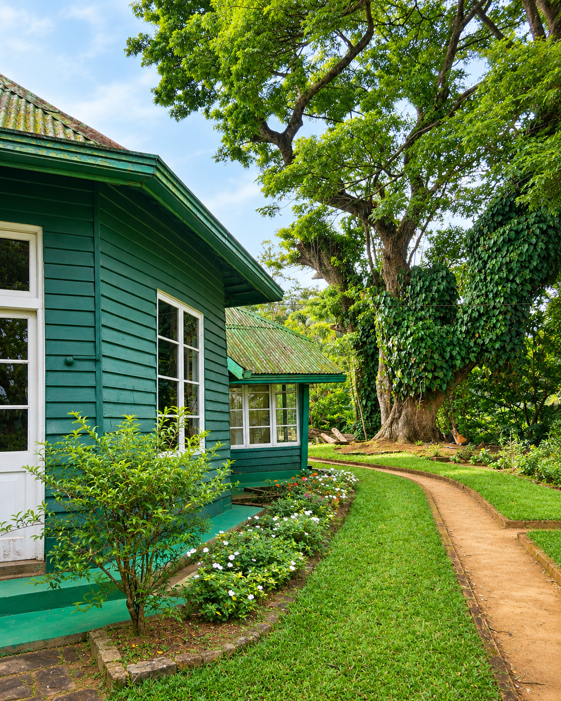
The ceiling, the timber floors and the fireplace make Royal Majesty feel old. The tea outside the windows explains why it exists. From the veranda the landscape can look natural in its perfection, and it is not. Every contour of tea is part of a commercial geography created during the nineteenth-century transformation of Ceylon’s highlands, and the house, the factories, the railway line, the line rooms, the reservoir and the paths between them all belong to the same historical system.
Most writing about places like this begins and ends with the house. This essay starts there and then widens, until the reader can see what the house is for. Royal Majesty Bungalow is a heritage property on Ireby Private Estate, near Norwood and Hatton. It is the doorway into a much larger story: how colonial agriculture transformed Sri Lanka’s central highlands, how tea became one of the island’s defining global products, and how walking the estate paths around Hatton and Norwood lets a traveller read that history directly in the land.
The larger question is what it means to stay inside a landscape that was engineered for empire and is still producing the same crop more than a century later. Sri Lanka has put that question to the world: in August 2025 it submitted “Sri Lanka’s Tea Cultural Landscape”, in the Central and Uva Provinces, to UNESCO’s Tentative List, arguing that colonial agriculture, railway engineering, plantation architecture, migrant labour, religion and mountain ecology fused into a single cultural landscape. A Tentative List entry is a preliminary step and not an inscription, and its content is the responsibility of the state that submits it. But the description is useful, and Hatton and Norwood are among the places where that fusion is easiest to see.
A method runs underneath what follows. Each element of the view is treated as evidence, and each piece of evidence is labelled by how far it can be trusted: an official listing, an industry history, a labour study, a property claim, or the writer’s own observation. The aim is a stay that is enjoyed and understood at the same time, which is a different thing from a stay that is simply photographed.
Before Tea, the Highlands Were Forest
The tea fields are not untouched nature. They are one of Sri Lanka’s most beautiful human-made landscapes.
The submission to UNESCO begins with a fact easy to forget when looking at manicured green hills: before the plantation industry, the central highlands were extensively covered in dense montane and cloud forest. The highlands are the island’s most geologically complex and ecologically significant region, with steep slopes, deep valleys, a temperate climate and heavy monsoonal rainfall. Large-scale deforestation cleared the forest to make room for plantations, so plantation agriculture transformed the ecology as well as the economy. To call the tea slopes wilderness is to erase that transformation. They are among the most carefully engineered landscapes in Asia.
The forest that was not cleared is also part of the picture. The Central Highlands of Sri Lanka were inscribed on the World Heritage List in 2010 for their biodiversity, and the area sits close to the tea estates. IUCN’s 2025 World Heritage Outlook assessed the conservation outlook of that site as “significant concern”, down from “good with some concerns” in 2017. A landscape that was once forest, and a forest that still needs protecting, are two chapters of the same history, and a visitor to a tea bungalow stands between them.

Royal Majesty Bungalow: A House Built for Tea Country
The most interesting thing about the bungalow is not that it looks colonial. It is that the agricultural system that produced it is still visible outside.
Property and booking listings describe Royal Majesty as a colonial-era tea planter’s bungalow, originally associated with a British family, that still carries its period features: timber floors, panelled walls, ceilings, fireplaces, antiques and extensive gardens, at an elevation of about 4,256 feet. Its age is given in those listings as roughly 140 to 150 years, and one booking site dates it to 1883. Those are the property’s own claims. The exact construction date and the original planter’s name are not independently documented in sources the public can readily consult, so they are reported here as what the listings say and not as archival fact. What can be said with confidence is that the type is unmistakable. Sri Lanka’s submission to UNESCO describes estate bungalows modelled on British prototypes, with fireplaces, steep pitched roofs and landscaped gardens that evoked the English and Scottish countryside.
There are three kinds of evidence for the age of a house, and it helps to name them. Documents, such as deeds, estate ledgers and planters’ records, can fix a date. Fabric, meaning joinery, roof forms and building technique, can place a house in a period. Comparison with similar houses can place it in a type. A listing is a claim that may rest on any of these, or on none. A responsible portrait says which, and where it cannot say, it says that too.
One distinction has to be made at once. Royal Majesty is a separate heritage property. It is not part of Ceylon Tea Trails, the collection of five restored planters’ bungalows (Castlereagh, Dunkeld, Summerville, Norwood and Tientsin) operated by Resplendent Ceylon in the same valley. In this essay “tea trails” refers to the physical estate paths and to the wider Pekoe Trail network through Hatton and Norwood, and the hotel brand is mentioned only to keep the two apart.
| Royal Majesty Bungalow | Ceylon Tea Trails | |
|---|---|---|
| What it is | A separate heritage bungalow on Ireby Private Estate | Five restored colonial-era planters’ bungalows |
| Operator | Its own owners | Resplendent Ceylon |
| Location | Near Norwood and Hatton, within a short drive or walk of Castlereagh Reservoir | The Dickoya and Bogawantalawa region, spread over several valleys |
| The bungalows | One house | Castlereagh, Dunkeld, Summerville, Norwood and Tientsin |
| “Tea trails” in this essay means… | The physical estate paths and the Pekoe Trail | A hotel brand, mentioned only to distinguish it |
The two should not be confused. Royal Majesty is not part of the Ceylon Tea Trails collection.
What is Royal Majesty Bungalow? Royal Majesty Bungalow is a heritage bungalow on Ireby Private Estate near Norwood and Hatton, described in property and booking listings as a colonial-era tea planter’s house originally associated with a British family. Listings describe period features such as timber floors, panelled walls, ceilings and fireplaces, and give an elevation of about 4,256 feet. Its age, often given as roughly 140 to 150 years or as dating from 1883, comes from property listings and is not independently documented in accessible archival sources.
Is Royal Majesty Bungalow part of Ceylon Tea Trails? No. Royal Majesty is a separate heritage property on Ireby Private Estate. Ceylon Tea Trails is a collection of five restored planters’ bungalows (Castlereagh, Dunkeld, Summerville, Norwood and Tientsin) operated by Resplendent Ceylon. In this essay, tea trails refers to the physical estate paths and to the wider Pekoe Trail network, not to that hotel brand.
Ireby Estate and the Working Landscape Around the House
The bungalow is heritage architecture inside a working agricultural landscape, not a detached museum.
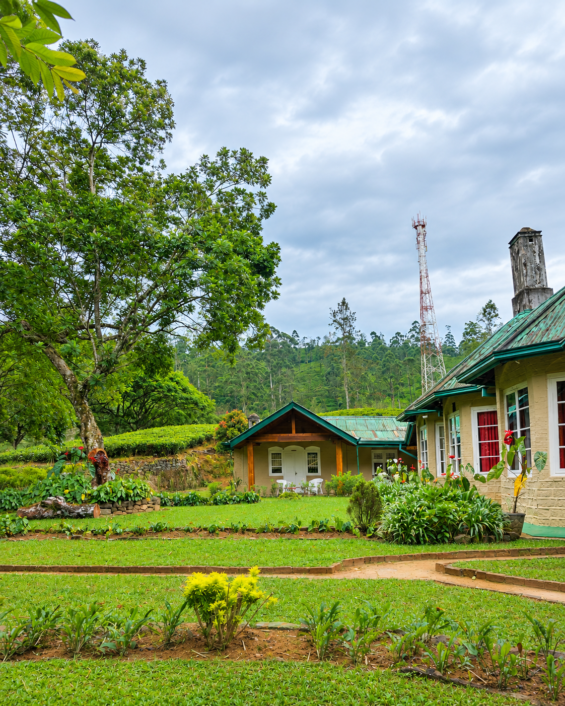
The house is only one part of Ireby Private Estate, which sits near Norwood within walking distance of Castlereagh Reservoir; listings put the reservoir at roughly a fifteen-minute walk. Local tea experiences on the estate still take visitors through the living process: walking among the bushes, meeting pluckers, and seeing leaf withered, rolled, dried, sorted and tasted. That continuity is essential, because a bungalow without a working estate is a set, and a working estate without its history is only a farm. Together they are legible.
The elevation is worth a sentence. Listings give about 4,256 feet, which is roughly 1,300 metres by conversion, a little above Hatton town at about 1,271 metres. Datums differ, so the comparison is approximate, but it makes a useful point: the house looks down on the commercial town it was built to oversee, which is how a planter’s residence was meant to sit within the estate.
The smell of a tea factory, the green sweetness of withering leaf, is part of what a place like this holds in memory, in the way that scent anchors a landscape in the mind, as The Language of Scent: How Fragrance Becomes Identity in Modern Beauty explores. It is also a reminder that the estate is a place of production first, and a place of leisure second.
What is Ireby Estate? Ireby Private Estate is the working tea estate near Norwood, within walking distance of Castlereagh Reservoir, on which Royal Majesty Bungalow stands. The estate matters because the house sits inside a working agricultural landscape and not a museum: visitors can still walk among the bushes and see how leaf is plucked, withered, rolled, dried, sorted and tasted.


Coffee Collapse and the Birth of Ceylon Tea
An agricultural crisis created the conditions for tea to remake the highlands.
The commercial transformation began with coffee. The British introduced coffee cultivation in the early nineteenth century, and it expanded rapidly until coffee rust, a fungus known as Hemileia vastatrix, devastated the crop. The Ceylon Tea Museum’s timeline dates the devastation to 1869, and the industry’s own published history places it in the 1870s; the safest reading is that the rust appeared in the late 1860s and had all but destroyed coffee within about two decades. The collapse took the colonial economy with it, and planters had to look for another export. The answer was tea.
Tea had been on the island for decades by then. The museum’s timeline records that a tea plant was brought from China to the Royal Botanical Gardens at Peradeniya in 1824, for non-commercial purposes. What changed in the 1860s was the decision to treat tea as a crop. The owners of Loolecondera Estate near Kandy had been interested in tea since the late 1850s, and in 1867 the Scottish planter James Taylor was put in charge of sowing the first tea seed on about nineteen acres. The commercial history of Ceylon tea is dated from that planting. The estate name appears as Loolecondera in English accounts and as Loolkandura in its Sinhala pronunciation, and the original planting is identified in industry histories as Field No. 7, which is reported to be growing still.
| Stage | What happened | What it left in the land |
|---|---|---|
| Before the plantations | The central highlands were extensively covered in dense montane and cloud forest | The ecology that was cleared and replanted |
| 1824 | A tea plant from China is planted at Peradeniya, non-commercially | Proof that the crop could grow, long before it was a business |
| Early 19th century | Coffee cultivation is introduced under British rule | The first commercial transformation of the hills |
| Late 1860s | Coffee rust (Hemileia vastatrix) devastates the crop | An agricultural crisis that opened the way for tea |
| 1867 | James Taylor sows the first commercial tea at Loolecondera, about 19 acres | The beginning of the formal tea industry |
| 1872 and 1873 | First sale of Loolecondera tea in Kandy; first consignment of 23 lb exported to London | A trade that began with a parcel and became an economy |
| Late 19th century onward | Tea spreads across the highlands; Tamil workers are brought from South India under indentured systems; a broad-gauge railway links estates to the ports | Factories, line rooms, kovils, churches and railway stations |
| Today | Tea is still grown and processed along the same contours | A continuous, working landscape |
Dates follow the Ceylon Tea Museum timeline and the description in Sri Lanka’s UNESCO Tentative List submission. Inclusion on a Tentative List is a preliminary step and not an inscription.
What is the history of tea in Hatton, Sri Lanka? The highlands around Hatton were once dense montane and cloud forest. The British introduced coffee in the early nineteenth century, and the coffee economy collapsed from coffee rust in the late 1860s and 1870s. James Taylor, a Scottish planter, sowed the first commercial tea at Loolecondera (Loolkandura) in 1867, and tea spread through the highlands. Hatton developed as a service centre, Tamil workers were brought from South India under indentured systems, and a broad-gauge railway carried the tea to the coast.
1867: How Tea Rebuilt the Central Highlands
Tea did not simply grow in the highlands. Tea reorganised the highlands.
James Taylor established Sri Lanka’s first commercial tea plantation in 1867, and the history of the industry is usually dated from there. Sri Lanka’s own account of the transformation, published on UNESCO’s Tentative Lists, reads like a design brief. Land was selected for elevation, rainfall, soil and water. Factories were placed on valley floors so that leaf could flow downhill, with cable systems and trolleys carrying the plucked leaf to them. Bungalows for European planters were positioned on elevated sites for climatic comfort, panoramic views and oversight of the plantations. Labour quarters, typically austere, were built in rows close to the fields. Tea was planted along contour lines, held in place by dry-stone retaining walls and engineered drainage.
The beauty of Hatton is therefore inseparable from infrastructure. Every element of the view has a function, and every function a history. The table below reads the landscape as an archive, element by element.
| What you see | What it records |
|---|---|
| The bungalow | Hierarchy: an elevated residence with fireplaces, pitched roofs and landscaped gardens modelled on British prototypes |
| The factory | Industry: sited low in the valley so leaf could flow downhill, with brass rollers, drying units and withering troughs still in use in places |
| The line rooms | Labour: austere terraced housing built in rows close to the fields, now home to communities of estate workers |
| The railway | Infrastructure: a broad-gauge line that carried tea from the highlands to the coast and the world |
| Kovils and churches | Belief: South Indian Hindu shrines and Gothic or Victorian churches within the same estates |
| Contour planting and stone walls | Engineering: tea set along contours, with dry-stone retaining walls and drainage channels to hold steep slopes |
| The reservoir | Water: the hydrological base that makes both tea and settlement possible |
| The estate path | Circulation: the practical geography that connected field, factory, house and town |
A reading of the landscape as an archive, drawing on the description of Sri Lanka’s Tea Cultural Landscape in the country’s submission to UNESCO’s Tentative List.
How did tea plantations change Sri Lanka’s central highlands? They replaced extensive montane and cloud forest with a planned agro-industrial landscape. Slopes were cleared and replanted along contours with dry-stone walls and drainage, factories were built in valleys, bungalows on elevated ground, and labour quarters in rows near the fields, while roads and a broad-gauge railway tied the estates to the coast. The change was ecological, economic and social, and it brought permanent Tamil estate communities to the highlands.
Why Hatton Became a Tea Capital
Hatton is valuable because the machinery of tea remains visible there.
Hatton sits at about 1,271 metres and grew during the colonial plantation period to serve first the coffee estates and then the tea estates. It developed into a service centre for the surrounding districts of Dickoya, Maskeliya, Talawakelle and Bogawantalawa, and it remains an important node in the region. The luxury-travel instinct is to bypass the town on the way to the estates. That is a mistake, because the town is where the system becomes visible: stations, roads, shops, workers, estates and the movement between them. Many of the surrounding estates carry Scottish place names, a small linguistic fossil of who planned the hills and from where.
What is Hatton famous for? Hatton is a hill-country town at about 1,271 metres that grew during the British colonial period to serve first coffee and then tea estates, and it is widely known as the tea capital of Sri Lanka’s hill country. It serves the plantation districts around Dickoya, Maskeliya, Talawakelle and Bogawantalawa, and it is a major station on the hill-country railway. Its value to visitors is that the machinery of tea, including stations, roads, shops, workers and estates, is still visible there.


The Railway That Made the Tea Economy Possible
The train connected mountain production to ports, capital and empire.
The famous hill-country train is usually described as one of the world’s most beautiful rail journeys. It is also industrial infrastructure. Sri Lanka’s submission to UNESCO identifies the broad-gauge railway as part of the structural backbone of the tea landscape: a line engineered through tunnels, bridges, viaducts and track loops to carry the plantations’ production to the coastal ports, and described there as one of the most remarkable engineering achievements of nineteenth-century South Asia. The submission also argues that it differs from India’s better-known mountain railways because this one was built to serve the tea industry. Railway stations from that period remain in use and retain colonial architectural features. To ride the line is to travel along the economic spine of the landscape, and to understand why tea became a global commodity: because it could be moved.
Four Systems, One Landscape: Leaf, Rail, Water and Labour
A view becomes evidence when you can name what holds it up.
It helps to stop looking at the view and start asking what keeps it standing. Four systems hold up the tea country of Hatton and Norwood, and each can be seen from the veranda, the road or the path. Leaf is the crop and the estate that grows and processes it. Rail is the line that moves it. Water is the rain, the reservoir and the stream that make both tea and settlement possible. Labour is the community of people whose work makes the other three function. Remove any one and the landscape stops being a working system and becomes a set.
| System | What it looks like on the ground | The question to ask |
|---|---|---|
| Leaf | Contour-planted slopes, valley-floor factories, withering and rolling | Who plucks, who processes, and where does the leaf go? |
| Rail | Stations, level crossings and the line threading between estates | What did this line carry, and who built and maintains it? |
| Water | Castlereagh Reservoir, Singamalai Lake, streams and drainage | Where does the water come from, and who depends on it downstream? |
| Labour | Line rooms, kovils, churches, shops, schools and paths between them | Who lives here, and what does the landscape look like from their side? |
A reading framework, not a survey. The questions apply to any plantation landscape.
Norwood and the Gateway to the Golden Valley
The landscape reads almost like a cross-section of the tea economy.
Norwood is the natural geographical extension of the Royal Majesty story. The Pekoe Trail describes it as the gateway to the Bogawantalawa Valley, historically known as the Golden Valley of Tea, a valley home to estates such as Norwood and Kew, framed by mountains shrouded in mist. The name is better understood as a reputation than a definition: sources do not agree on a single origin for the phrase, but they agree on what it signifies, a high-grown tea district whose cup is prized.
The valley also holds the quiet infrastructure that the postcard hides. In the evening, with the mist coming down and a fire lit in a grate that was built for a planter’s family, the combination of cold air, woodsmoke and stillness is the atmosphere that the plantation world was designed to produce for its managers. The way weather and light make a place, as Inside the Atmosphere Economy: How NEOM Is Redefining Modern Home Wellness explores, is part of what a stay here offers, though it is worth remembering for whom that comfort was first designed.
Why is Bogawantalawa called the Golden Valley of Tea? The name reflects the valley’s standing among Sri Lanka’s high-grown tea districts, with estates such as Norwood and Kew, and the Pekoe Trail describes Norwood as the gateway to the valley. Sources do not agree on a single origin for the phrase, so it is best understood as a reputation. The valley is home to some of the island’s most admired tea and to the communities who produce it.


Walking Stages 7 and 8 of the Pekoe Trail
The path is part of the archive.
The Pekoe Trail makes the history walkable. It is a curated route of about 300 kilometres in 22 stages across Sri Lanka’s central tea country, and Stages 7 and 8 pass through Hatton and Norwood. Walking them changes a traveller’s relationship to tea. Instead of seeing plantations from a car window, you move through factory roads, villages, worker housing, religious sites, rivers, railways and estate paths, and you find that the trail exists because the plantation system had already created paths between fields, factories, housing and towns. Walking means using the same practical geography through which the tea economy functions. It is not a scenic hike with tea added.
Stage 7 runs from Kotagala to Norwood. It passes Drayton Estate and an old tea factory, crosses the railway line, and climbs to a hill from which Hatton appears below. It reaches Singamalai Lake, a small lake that supplies drinking water for Hatton and the surrounding villages, and then opens onto rolling green slopes and the first view of Castlereagh Reservoir. Along the way it passes line rooms, the terraced housing of estate workers, and descends through estate paths into Norwood. It is one of the strongest parts of the walk because it prevents tea country from becoming a purely visual fantasy.
Stage 8 begins in Norwood and climbs the ridge that separates the Bogawantalawa and Maskeliya valleys, descending through Norwood Estate with views over the Maskeliya side and, across the lake, a glimpse of Adam’s Peak. Later it enters the Kew Estate, where the official profile points to the Kew Estate Tea Factory, and it continues through working countryside to Bogawantalawa town. This is where landscape, labour and history become inseparable.
| Stage 7 | Stage 8 | |
|---|---|---|
| Route | Kotagala to Norwood | Norwood toward Bogawantalawa |
| Length | About 16 km | About 16 km |
| What it passes | Drayton Estate, an old tea factory and Chrysler’s Farm Tea Factory, crossings of the railway line, a planters’ club, Singamalai Lake, views of Hatton and of Castlereagh Reservoir, rows of line rooms | A climb to the ridge between the Bogawantalawa and Maskeliya valleys, Norwood Estate, estate paths, the Kew Estate and its tea factory, and views of Adam’s Peak across the lake |
| What it reads like | A cross-section of the working tea economy: factory, rail, housing, water | The Golden Valley of Tea, approached from its gateway |
The Pekoe Trail is a curated route of about 300 km in 22 stages across Sri Lanka’s central tea country. Published distances differ between sources (roughly 15 to 16.5 km for Stage 7 and 15.6 to 15.9 km for Stage 8), so check the official route notes before walking.
A few practical disciplines belong to a walk of this kind. Check the current official route notes before setting out, because stage status and signposting change and at least one official stage profile has described a stage as walkable but not yet fully signposted. Ask whether a trail pass is required, since some operators say one is. Walk with a guide where possible, and walk through estate land and villages with the permission and consent of the people who live and work there. The trail passes homes, not a theme park.
What is the Pekoe Trail near Hatton? The Pekoe Trail is a curated long-distance walking route of about 300 kilometres in 22 stages across Sri Lanka’s central tea country. Near Hatton, Stages 7 and 8 pass through estate roads, factories, railway crossings, worker villages, kovils and churches. Walking the trail changes how tea country is seen, because it follows the practical paths between fields, factories, housing and towns, and not only viewpoints.
What are stages 7 and 8 of the Pekoe Trail? Stage 7 runs from Kotagala to Norwood, about 16 kilometres, passing old tea factories, Singamalai Lake, which supplies drinking water to Hatton and surrounding villages, line rooms and views of Castlereagh Reservoir. Stage 8 runs from Norwood toward Bogawantalawa, also about 16 kilometres, climbing the ridge between the Bogawantalawa and Maskeliya valleys, passing Norwood Estate and offering views of Adam’s Peak across the lake.
The Communities Behind the Green Hills
The bungalow’s elegance and the workers’ history belong in the same narrative, not in separate footnotes.
No honest account of a planter’s bungalow can leave out the people who made it possible. The plantation model depended on a paid labour force of South Indian origin. In the words of Sri Lanka’s own submission to UNESCO, large numbers of Tamil workers were brought to Sri Lanka under indentured systems to meet the demand for estate labour, and over time they established permanent communities that reshaped the demographic composition of the region. The same document records oral histories that begin with displacement: families uprooted from Tamil Nadu, the crossing of the Palk Strait, and long marches from coastal ports to the upland plantations, often barefoot. It also records what those communities built: Hindu kovils dedicated to deities such as Murugan and Kali, festivals, graveyards, and a religious geography that sits beside the planters’ Gothic and Victorian churches.
Today the tea sector is both a national industry and a place of continuing labour concerns. The International Labour Organization describes tea as a major employer in Sri Lanka, particularly of women, and its plantation safety programme notes that the sector provides employment for over 2.5 million people. Its smallholder study, launched in December 2018, found that about 70 percent of the country’s tea is produced by roughly 475,000 smallholders, a sector whose sustainability is challenged by rising costs, falling prices and climate change. Amnesty International’s May 2026 report on Malaiyaha Tamil workers on private estates and smallholdings in the Southern Province, based on visits to 45 estates in the Galle and Matara districts, describes abuses that it says meet many of the ILO’s indicators of forced labour. That report concerns particular estates and does not describe Hatton or any estate named here, and it should not be read as doing so. It is, however, a reminder that the history in the line rooms is not only history.
The visual rule follows from this. Tea workers should be photographed with dignity and context, as people with names, homes and work, and not as decorative figures against a misty slope. Those who live in the estates are not scenery, and the landscape is theirs as much as anyone’s.
Castlereagh, Adam’s Peak and the Geography Around the Estate
Industrial, spiritual and ecological geographies overlap here, and that is why the highlands are so culturally dense.
Castlereagh Reservoir recurs through the visual geography of Hatton and Norwood. From estate paths and ridges it is a counterpoint to the planted slopes, and it is a reminder that the highlands are hydrological infrastructure as well as agricultural space: water, elevation and rainfall are fundamental to both tea and human settlement. A reservoir is also a protected boundary on which everything downstream depends, the same logic that makes the protection of a barrier the precondition for everything built on it, a principle examined in The Return of Barrier Beauty: Why Lanolin Is the Ultimate Skin Investment. Singamalai Lake, which supplies drinking water to the town, makes the point in a smaller way.
The reservoir has a second life that the tea postcard rarely mentions. Reference summaries describe Castlereagh as a dam across the Kehelgamu Oya, a tributary of the Kelani River, and the Ceylon Electricity Board’s description of the Laxapana complex explains how water collected in the Castlereagh reservoir is brought down a power tunnel to the Wimalasurendra power station, where it drives turbines, and then continues through the other stations of the complex. The reservoir that frames the view from the estate is, in other words, part of the national electricity system. Reference sources add that it takes its name from Lord Castlereagh, the British statesman of the early nineteenth century, one more reminder that the names on the map belong to the same history as the tea.
Beyond the water, Sri Pada, or Adam’s Peak, rises in the distance, one of Sri Lanka’s most sacred mountains, revered by several faiths. A landscape built around colonial export agriculture sits within sight of it. The coexistence of an industrial economy, a living pilgrimage and a mountain ecology within a single view is one of the reasons that Sri Lanka’s own submission argues the region is so unusually layered, with sites elsewhere in the tea country linked, for Hindu communities, to the Ramayana.


Why Staying in a Plantation Bungalow Changes the Experience
The luxury is not the number of amenities. It is duration inside the landscape.
A planter’s bungalow was a social machine. It was residence, management centre, hospitality space and symbol of authority, and its elevated lawns, fireplaces and formal rooms, and its separation from workers’ housing, encoded hierarchy in architecture. Modern hospitality can preserve the building while changing its meaning, and the most honest stay is one that knows both. That is the architecture of power at the scale of a house, form used to express authority, as The Architecture of Power: How Sculptural Footwear Defines Modern Luxury examines at the scale of an object.
What a stay offers that a day visit cannot is time: morning mist, changing light, estate sounds, fires in the evening, and walks that begin at the door, which give a traveller a sense of the climate and rhythms that shaped plantation life. Guest accounts value Royal Majesty precisely because it keeps the atmosphere of an old plantation house and does not behave like a new-build resort. That is a theme worth defending. Sometimes preservation means resisting the pressure to make every heritage property look globally interchangeable. Period furnishings carry meaning that grows with use and time, an idea explored in The Language of Modern Necklaces: Metals, Stones, and the New Codes of Personal Luxury, and the value of an old bungalow is not that it performs new luxury perfectly. It is that enough of the old world remains legible.
Why are colonial tea bungalows historically important? Because they record how power was organised inside the plantation system. Bungalows were modelled on British prototypes with fireplaces, steep roofs and landscaped gardens, and were placed on elevated sites for climate, views and oversight of the estate, apart from the austere line rooms of workers. Preserved with care, they let visitors read both the architecture of authority and the labour that sustained it, which is why they must be understood alongside the history of the people who worked the estate.
The Problem With Colonial Romance
The right tone is neither guilt nor nostalgia. It is literacy.
The visual appeal of fireplaces, lawns and old planter furniture is undeniable, and a serious essay can enjoy those details without letting them erase the extractive system that financed them. Heritage preservation is not celebration of colonial power. It is the decision to keep evidence, and evidence is most useful when it is read honestly. Heritage becomes more valuable when we understand the full history it carries, including the labour that built it and the forest that was cleared for it.
Literacy can be practised. It means asking who is absent from the room as well as who is in it. It means noticing which stories the house tells easily, such as the planter, the garden and the fire, and which it tells only if asked, such as the household staff, the pluckers, the line rooms and the families who have lived on the estate for generations. A stay that asks both sets of questions is richer, and it is also more truthful.
| A better way to experience Hatton | Why it matters |
|---|---|
| Stay long enough to see the house at different hours | Duration, not amenity, is the luxury |
| Walk part of the estate and the Pekoe Trail | Paths are part of the archive |
| Visit a working factory and follow the leaf to the cup | The machinery is still in use |
| Ask about the estate community, not only the planters | The labour history is the other half of the house |
| Use Castlereagh and Norwood to understand the wider geography | Water, valley and town explain the estate |
| Treat workers and villages as part of the living landscape | People are not photographic props |
| Drink the tea after learning where and how it was made | Provenance is the point |
Practices, not prescriptions. Visit estates and trails with the permission and guidance of those who live and work there.
Tea as Commodity, Landscape and Memory
Hatton lets the traveller reverse the abstraction.
Ceylon tea became a global brand, a name known on shelves far from the island, and, as the industry’s own history records, the brand survived even the country’s change of name in 1972. Hatton lets the traveller reverse that abstraction: to walk backward from the branded commodity into the fields, workers, factories, weather and land that produced it. That is the strongest link between luxury travel and economic history. Modern luxury increasingly prizes provenance, and tea country offers the literal version of it, where the field can be seen, the factory visited, the process explained and the cup tasted in the same landscape. The same appeal of origin, the desire to know where a thing comes from and what it took to make, runs through the world described in The Return of the Pearl: Inside the Quiet Luxury of Robert Wan , and it is why a cup of tea drunk here tastes of more than tea.
The commercial scale of that abstraction is easy to underestimate. The Ceylon Tea Museum’s timeline records a first export consignment of just 23 pounds in 1873, and a record London auction price of Rs. 36.15 per pound for Ceylon tea in 1891. A trade that began with a parcel became, within two decades, an auction-house reputation. A traveller who stands in a field and a factory sees, in a single morning, how the one became the other. For readers who value pieces and places that carry this kind of earned permanence, our guide to timeless luxury fashion pieces applies the same test of lasting value to what a person chooses to own and wear.
Heritage travel is moving from isolated monuments toward landscapes, and Sri Lanka’s tea country matters because the architecture, agriculture, communities and infrastructure still function together. As destinations become more homogenised, places where economic history remains readable in the physical environment may become more valuable, and Hatton’s future luxury lies in preserving continuity without sanitising history. Readers who want the wider island in the same frame can follow it in our portrait Sri Lanka, Closer to the Land: Tea Country, Sacred Cities and the Wild South .
How To Read A Plantation Stay
A heritage stay is easy to enjoy and harder to read. These questions make it readable.
The questions below apply to any converted planter’s bungalow, estate hotel or tea-country homestay, in Sri Lanka or anywhere else a crop once organised a landscape. They are offered as a habit of attention, not as a scorecard.
The first question is what the house claims, and what can be shown. A traveller should separate the listing from the archive, and the story from the fabric, because a stay can describe its past in generous terms while the building itself says something more modest. The second is whether the estate is still working. A house inside a working landscape explains itself, while a house beside a decorative one does not.
The third is whose history is told, and whose is missing. It is worth looking for the pluckers, the household, the line rooms and the families as well as the planter, since a heritage that names only the person who owned the house has told only part of it. The fourth is what the stay leaves in the place. Employment, repair and respect for the estate community are different from a view with a bed attached, and the difference shows over years and not on a first visit.
The last is whether a guest could walk out of the door and read the landscape. If a path begins at the threshold, the house is part of its surroundings. If not, it is only a destination.
Why a Hatton Stay Changes Your View of Sri Lanka
The island most travellers picture is on the coast. The one Hatton shows you is in the hills.
Most visitors arrive in Sri Lanka expecting the island lifestyle: warm sea air, palm-lined beaches, long days outdoors and evenings that stay soft after dark. A stay in Hatton quietly replaces that picture. The hill country sits well above the coast, and the weather changes with it. Mornings can be cool and misted, the light arrives slowly across the tea, cloud moves through the valleys, and rain is part of the landscape and not an interruption to it. A traveller who expected a beach holiday finds a mountain one, and finds that Sri Lanka has more than one climate and more than one way of living in it.
The experience changes with the weather. On the coast, days are organised around the sea and the shade. In Hatton they are organised around the estate: the early start, the walk along a tea path, the return to a verandah and a pot of tea, the evening fire or the closed window. Life here moves at the pace of a working landscape, and that pace is slower and more deliberate than the island lifestyle most itineraries promise. The stay does not offer less luxury than the coast. It offers a different kind, one made of stillness, cool air and the sense of being inside a place that is still at work.
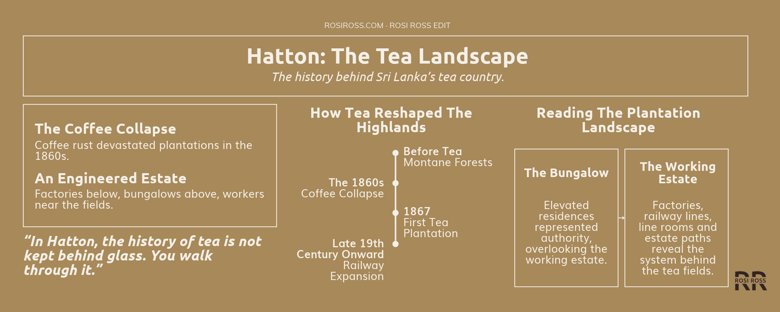
That difference is the point. Seen from the coast, Sri Lanka can read as a tropical island. Seen from Hatton, it reads as a mountain country shaped by coffee, tea, empire, railways, migrant labour and global commerce, and still legible today through the trails around Hatton and Norwood. A stay inside a colonial-era plantation house on Ireby Estate is a window onto one of the island’s most consequential cultural landscapes, and it changes what a traveller thinks the island is. The history of tea is not kept behind glass. You walk through it, in cool air, with the weather as part of the lesson.
A view worth holding is one that can say what would revise it, and this one is conditional. UNESCO’s decision on the tea landscape, which is a Tentative List entry and so a preliminary step, would strengthen or leave unchanged the language of this essay. Archival evidence such as deeds, estate records or building surveys could replace the cautious attribution of Royal Majesty’s date and first owner with fact. Independent inspections, prosecutions or reforms following the Amnesty report, and any comparable study of up-country estates, would change the weight of the labour caveat in either direction. Pekoe Trail signposting, access rules and pass requirements change, so stage descriptions should be checked against current official notes. And a change in the conservation outlook of the Central Highlands would alter how the tea landscape and the forest around it are read together.
The story is not that Royal Majesty is a beautiful old bungalow surrounded by tea. It is that a few nights in the hills will change how you picture the whole island. In Hatton, the beauty is not separate from the history. It is the history made visible, and the cool, misted air is part of why it stays with you.
“In Hatton, the landscape is an archive.
The bungalow is old.
The land outside explains why.
The path is part of the archive.
The history of tea is not kept behind glass.
You walk through it.
The beauty is the history made visible.”

